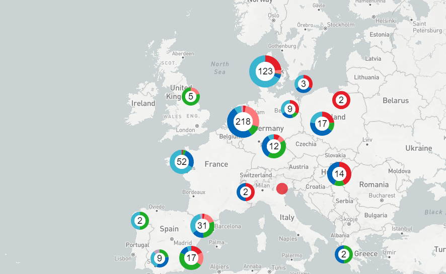


Ceva unveils interactive map to track swine flu
Ceva Animal Health has developed a new service that illustrates the progression of reported swine flu outbreaks across Europe.Ceva Animal Health has launched a new Interactive Swine Flu Map which will help veterinary surgeons and farmers track the disease across much of Europe.
The map, hosted on the Ceva website, shows the development of the strains of influenza detected on pig units by country and even by region. It is updated on a quarterly basis.
Dr Kathrin Lillie-Jaschniski, a specialist veterinary surgeon working with Ceva, said: “To be able to make the correct diagnosis and decide upon the appropriate prevention and vaccination programme, it is important for veterinarians and farmers to know if influenza is occurring in their region and also the different strains.”
Ceva was able to develop this service through its support of the diagnosis of influenza in Europe over the past decade.
Scientists analyse a variety of samples – including nasal swabs, oral fluids and lung tissues – taken from herds with acute clinical signs of flu, or those with persistent respiratory or reproductive symptoms to detect the virus.
Individual farms are not identified on the Interactive Swine Flu Map to protect farmers’ privacy. Ceva states that this is especially important in less pig-dense areas.
“Evidence that classical and pandemic strains of flu are occurring in a particular region gives a strong signal that vaccination should be considered.” Says Dr Lillie-Jaschniski. “Pandemic strains can also spill over from pigs to humans and vice versa, so there is a public health aspect, too.”
The service is currently available for free in Germany, UK, Poland, Czech Republic, Ireland, France, Spain, Portugal, Netherlands, Belgium, Denmark, Hungary and Italy.


